Category: Photo

  • Photos from December 2023 SF Boise Visit

    River and watershed conditions, such as risk of soil erosion, become most apparent in the winter when the growing season is over and vegetation growth does not obscure ground conditions. A field trip to the South Fork Boise River shows a number of the sites where some erosion control could be implemented.

    This stack of photos is in a .pdf format and is a huge 200 MB file and can be accessed here. It will open in a new tab.

  • March 30: Pierce Creek Riparian Planting

    A final step in restoring Pierce Creek will happen on March 30, 2019 and we need volunteers to make it reality. Planting the streamside area around the rebuilt bridge at Pierce Creek (on the South Fork of the Boise River, near the Danskin boat ramp) will stabilize the stream bank of this important habitat.

    The Pierce Creek Bridge was installed in 2011 and the footings were then rebuilt in 2018 after watershed debris flows undermined the foundation. This project was inspired and led by Trout Unlimited, working with the Mountain Home Highway District and the Boise National Forest. With a bridge replacing a culvert on Pierce Creek, the free passage of wild trout and other fish species is secured for this tributary to the South Fork Boise River.

    Join the contingent of volunteers to help finish the job at Pierce Creek.

    The particulars:

    • Saturday, March 30, 2019.
    • Meet at the Albertson’s parking lot at Federal Way and Gowen Road between 8:30 a.m. & 9:00 a.m. We will make carpool arrangements and leave from there at 9:00 a.m. and carpool to the South Fork Boise River.
    • In the morning we will gather willow cuttings at locations along the South Fork Boise River.
    • In the afternoon we will plant the cuttings in the bank along Pierce Creek.
    • Lunch will be provided by Ted Trueblood Chapter of Trout Unlimited, using our eager and experienced cooking crew and equipment from our summer Trout Camp.
    • Total work time is estimated to be four to six hours. Mid-afternoon return to Albertson’s in Boise.
    • Bring work gloves.  Bring a folding chair if you have one for sitting at lunch.
    • Please RSVP to Bruce Johnstone at [email protected] by Thursday March 28.
  • Sediment Movement shown in Photographs

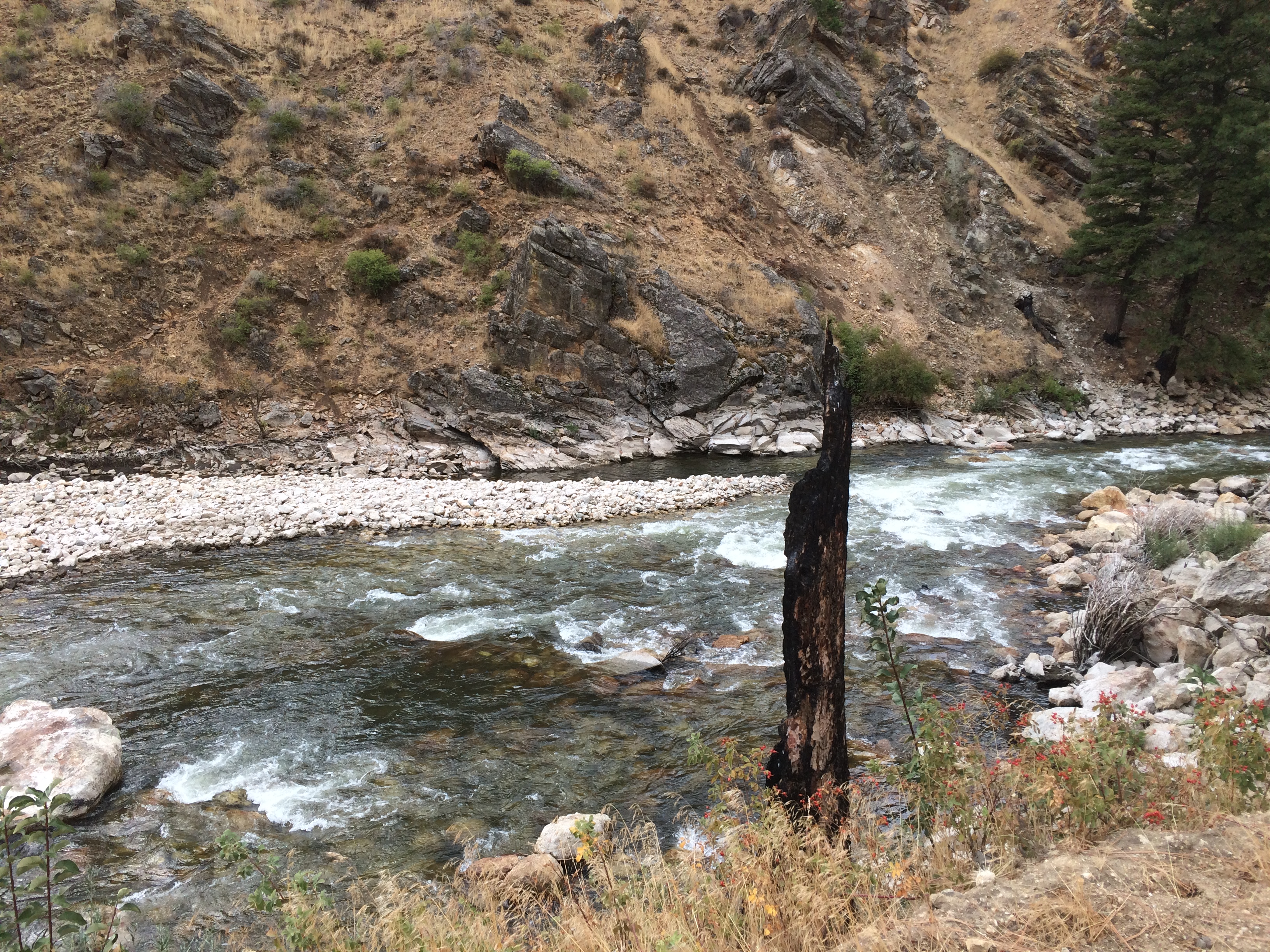
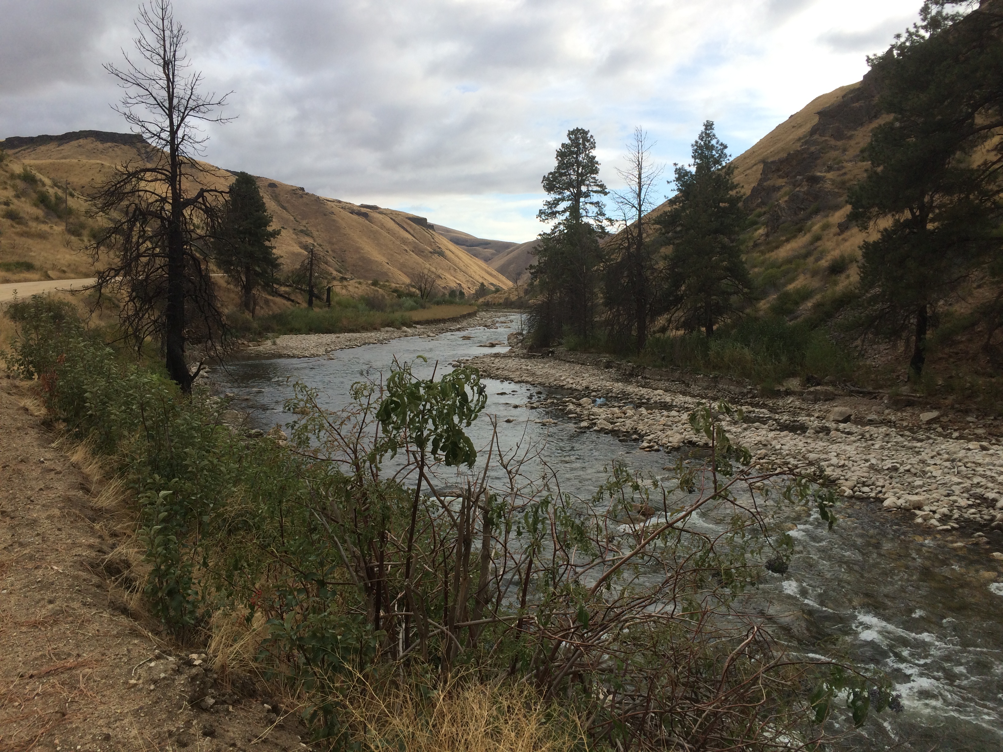
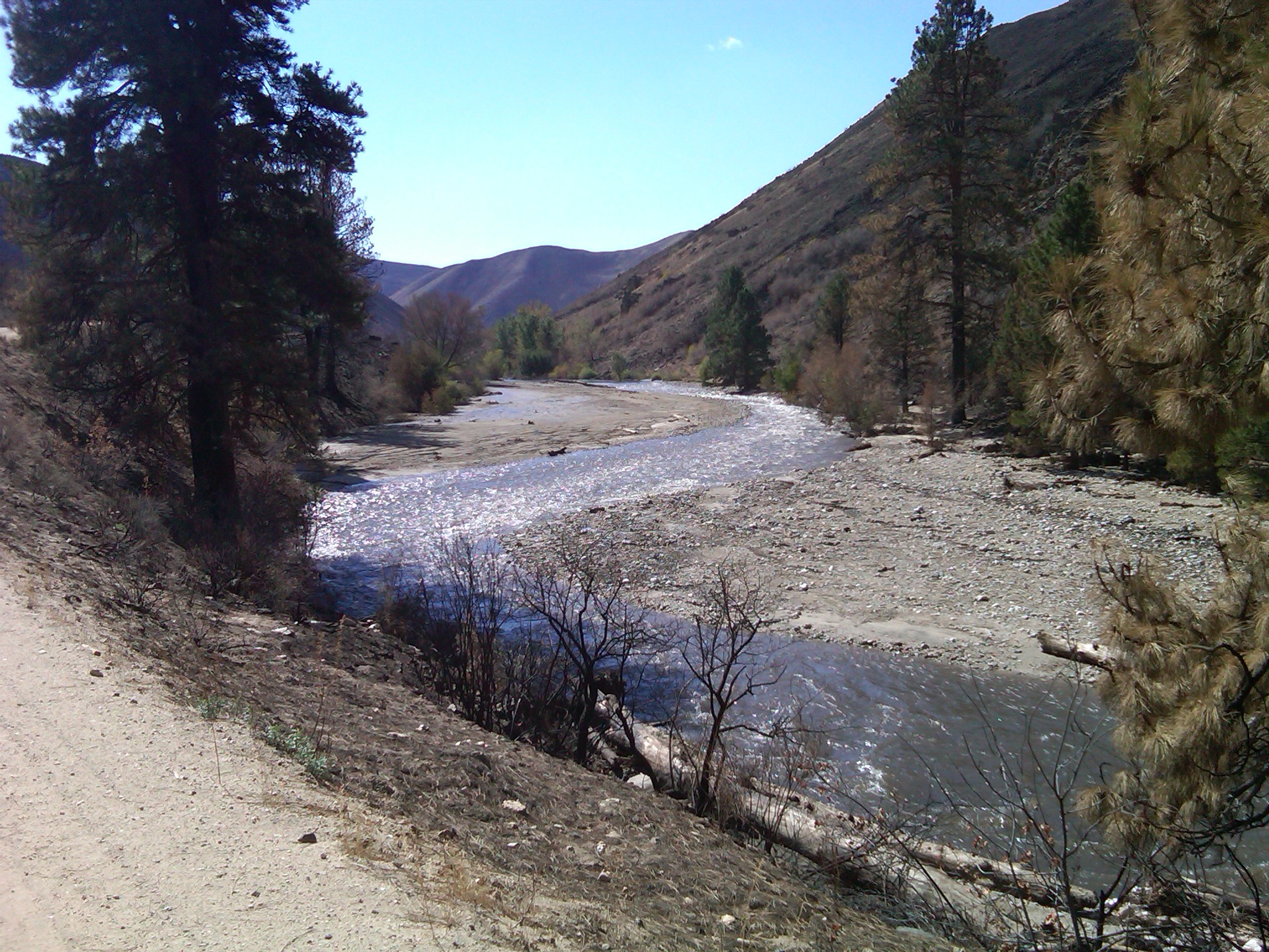
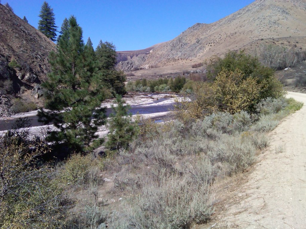
    Here are some photographs showing the movement of sediment from the Granite Creek area where it enters the South Fork Boise River just upstream of the “Pine Tree Hole” a mile or so downstream of Cow Creek bridge.

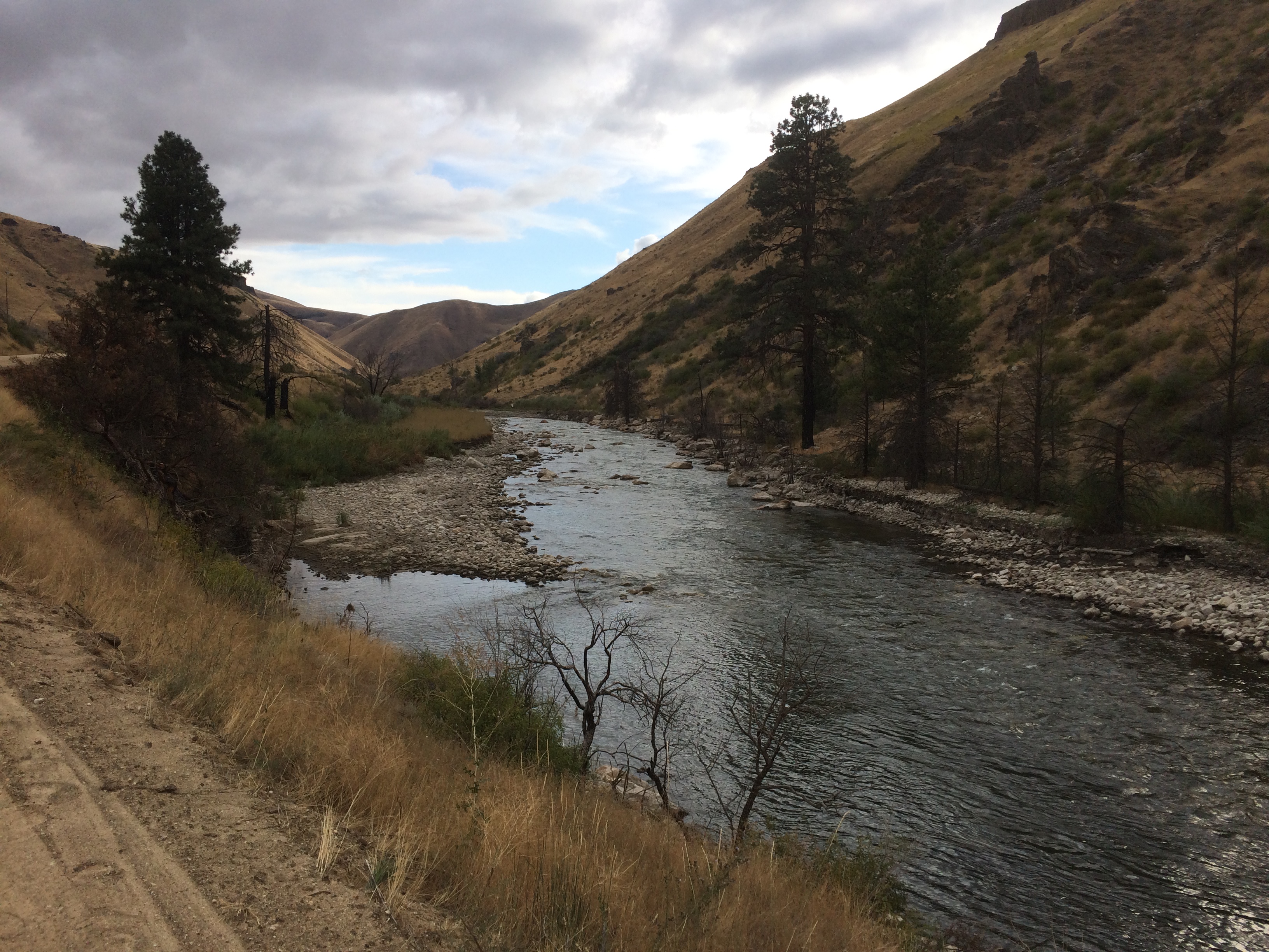
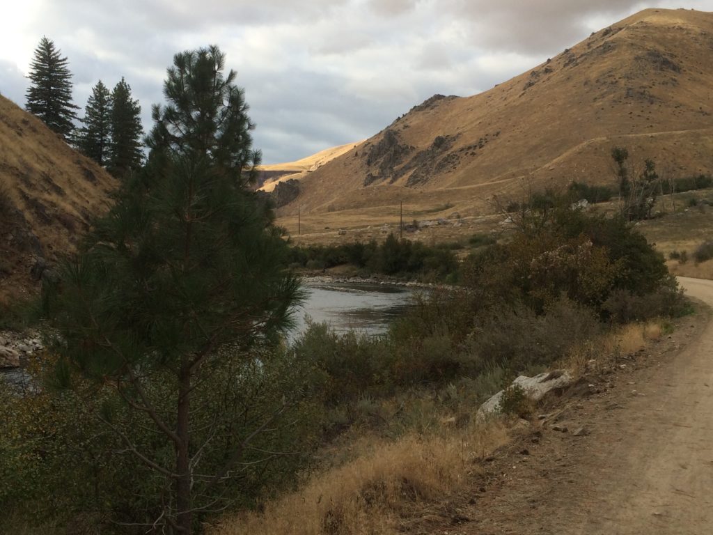
    The debris or mud flows occurred on September 12, 2013.  The first set of photos was taken Sept. 16, 2013.  A comparison photo for the same area was taken Sept. 22, 2017.  River flows on both days was 300 cfs.


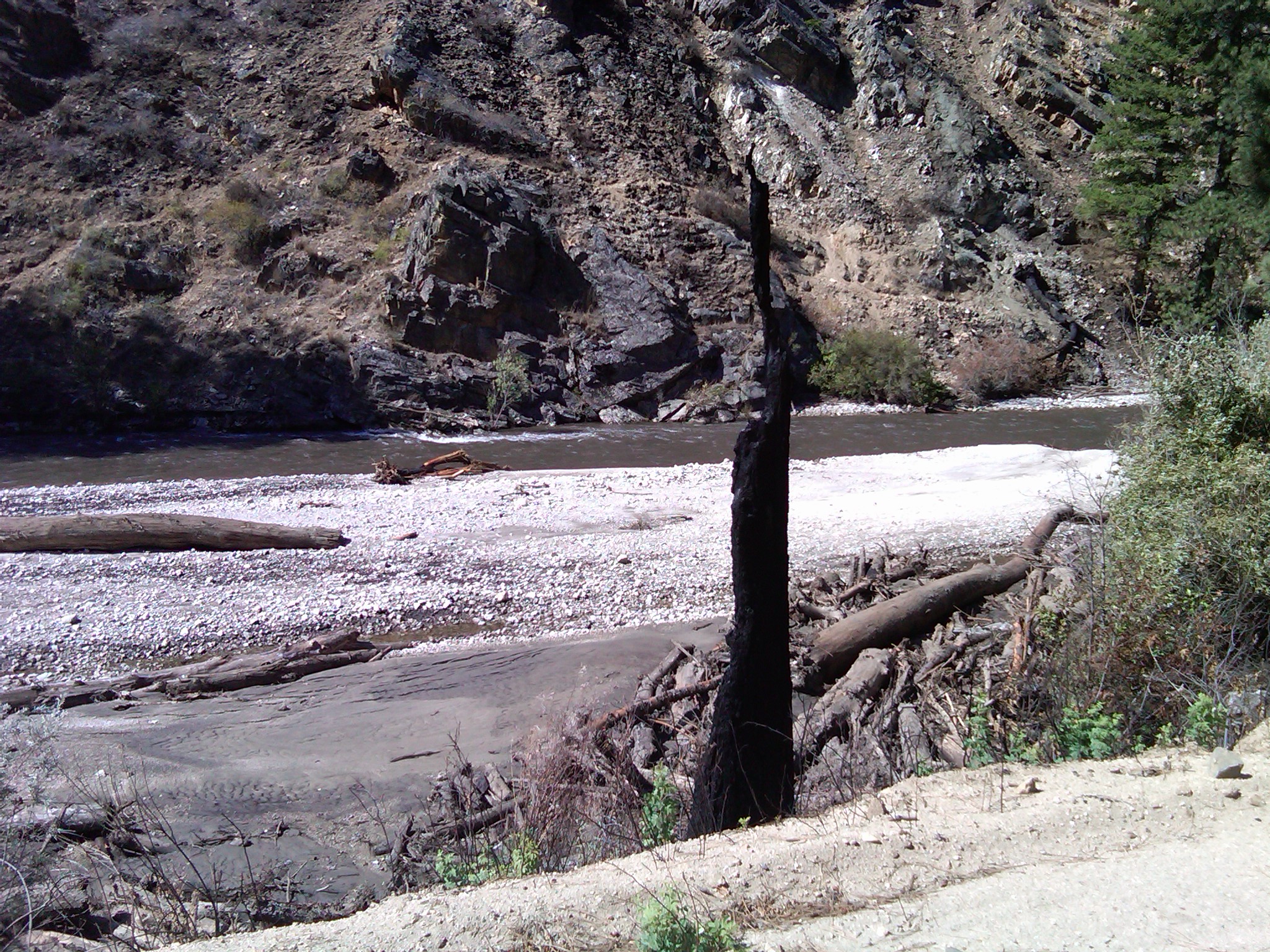
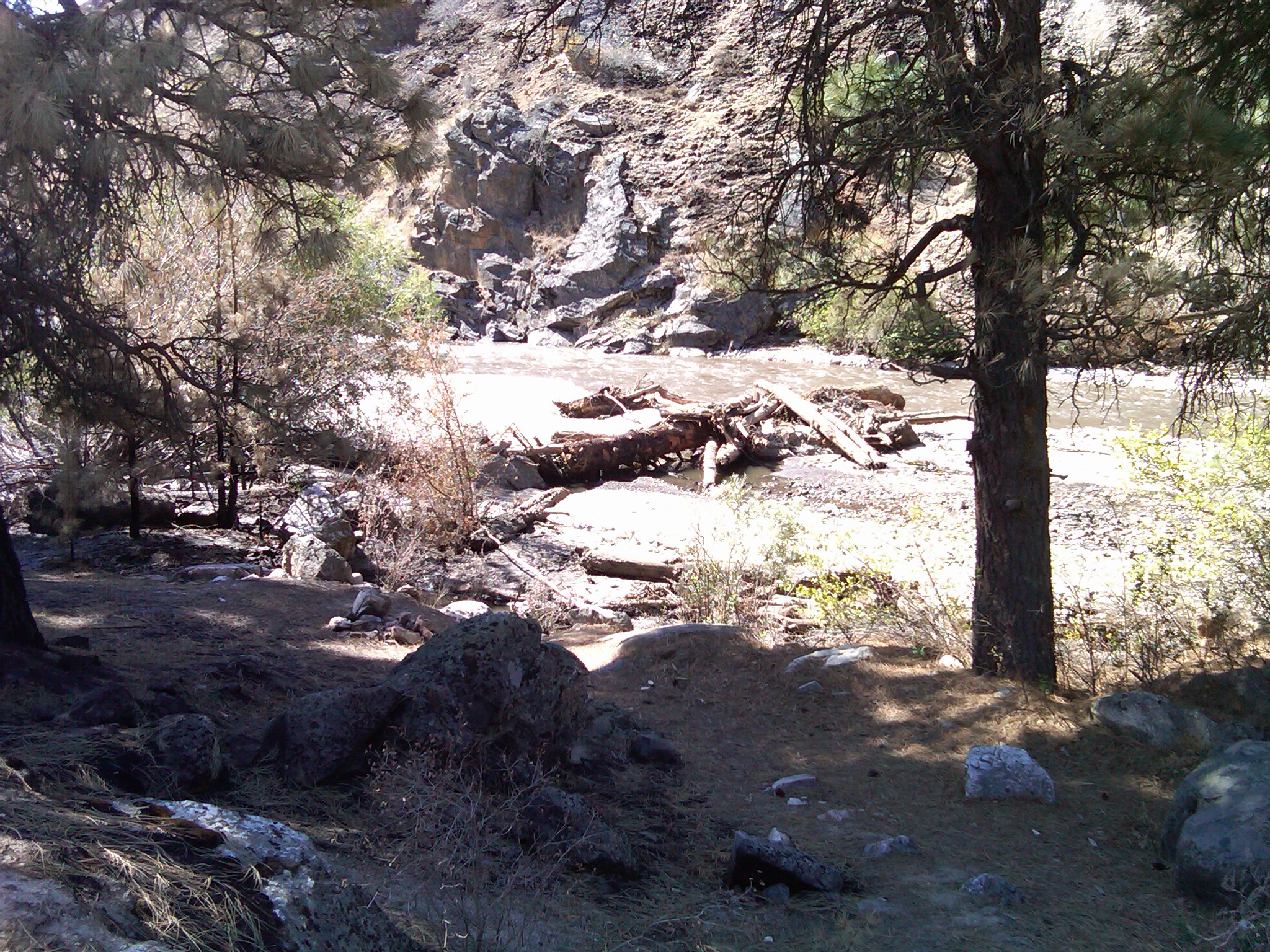
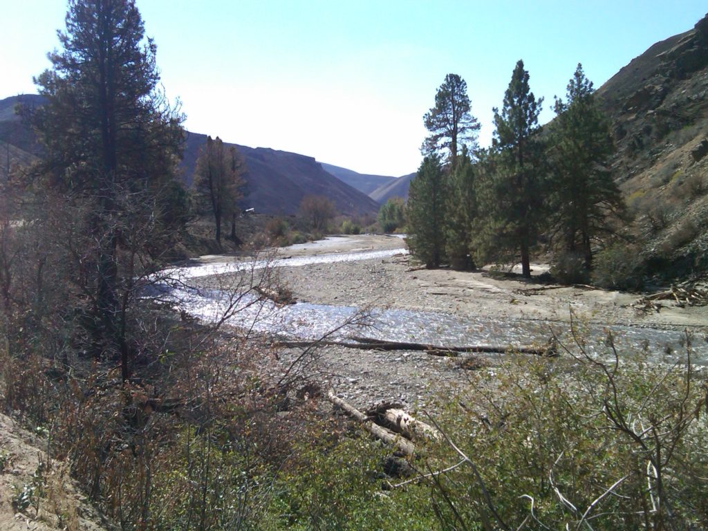
    Enough of the burned tree trunk remains to line up the photo point.  Smaller sediment is scoured and gone, as is the wood.


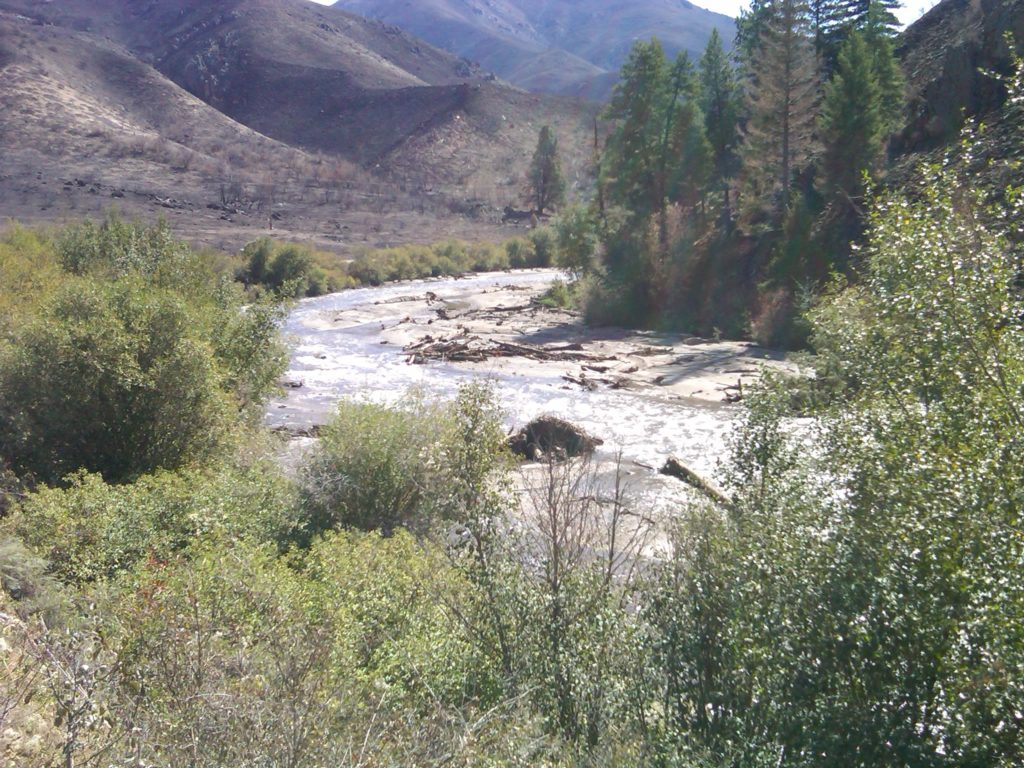
    That big tree bole in the upper photo is long gone.  When flows are at 7,000+ cfs it floats the logs downstream.


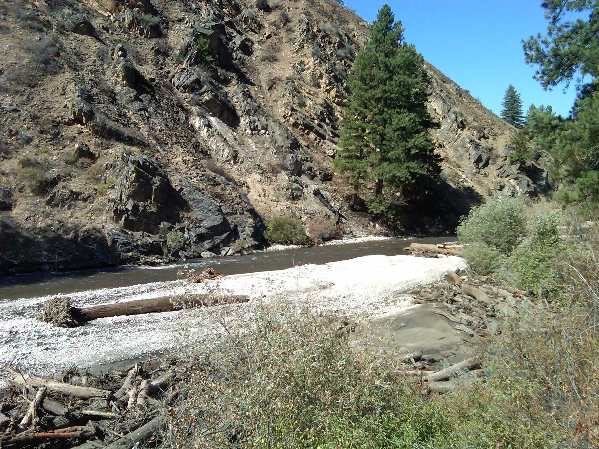
    Upper photo just three days after the debris flows and a sinuous channel was routed through the sediment.  Four years later the smaller particles are gone and channel is widening, exposing the larger rock that was deposited from the Granite Creek blowout.


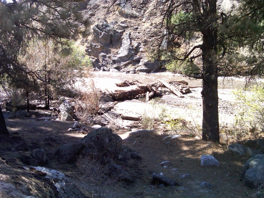
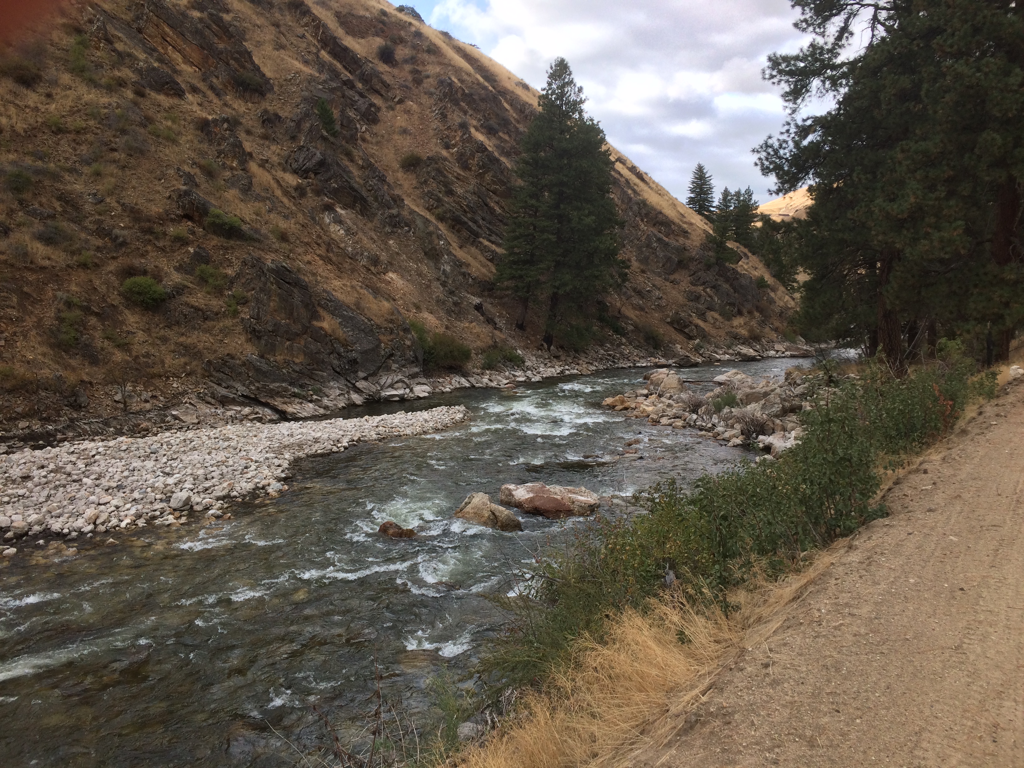
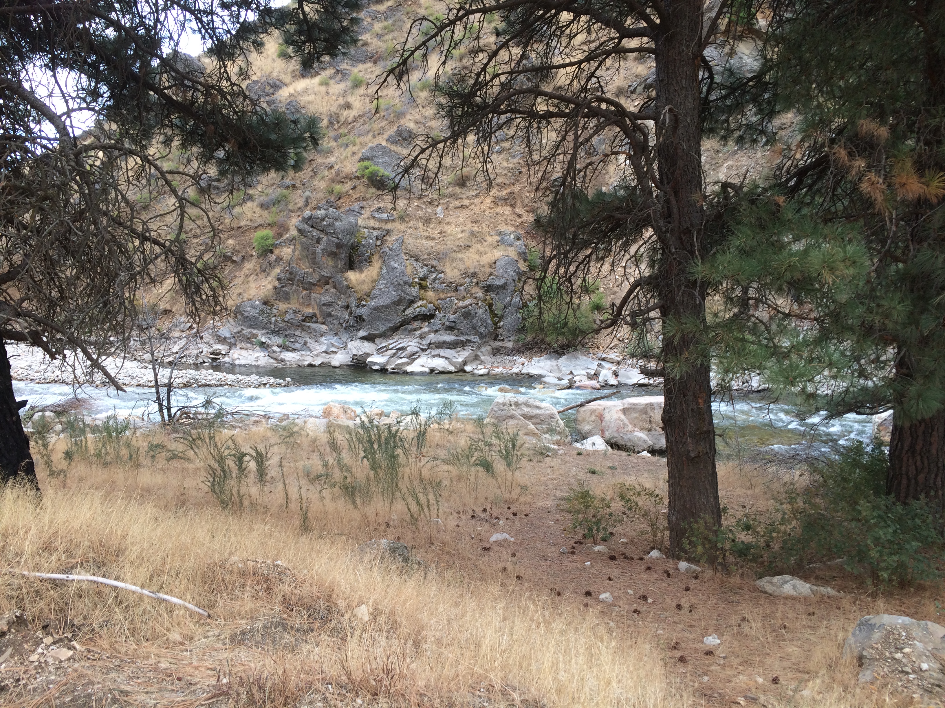
    The big pile of trees on the large rocks are now washed away.  Moreover the large boulders are now re exposed after the river flows scoured the sediment.


    Looking downstream the deeper hole appears to have reformed.  In the distance the hillside appears barren of sage brush and bitter brush.


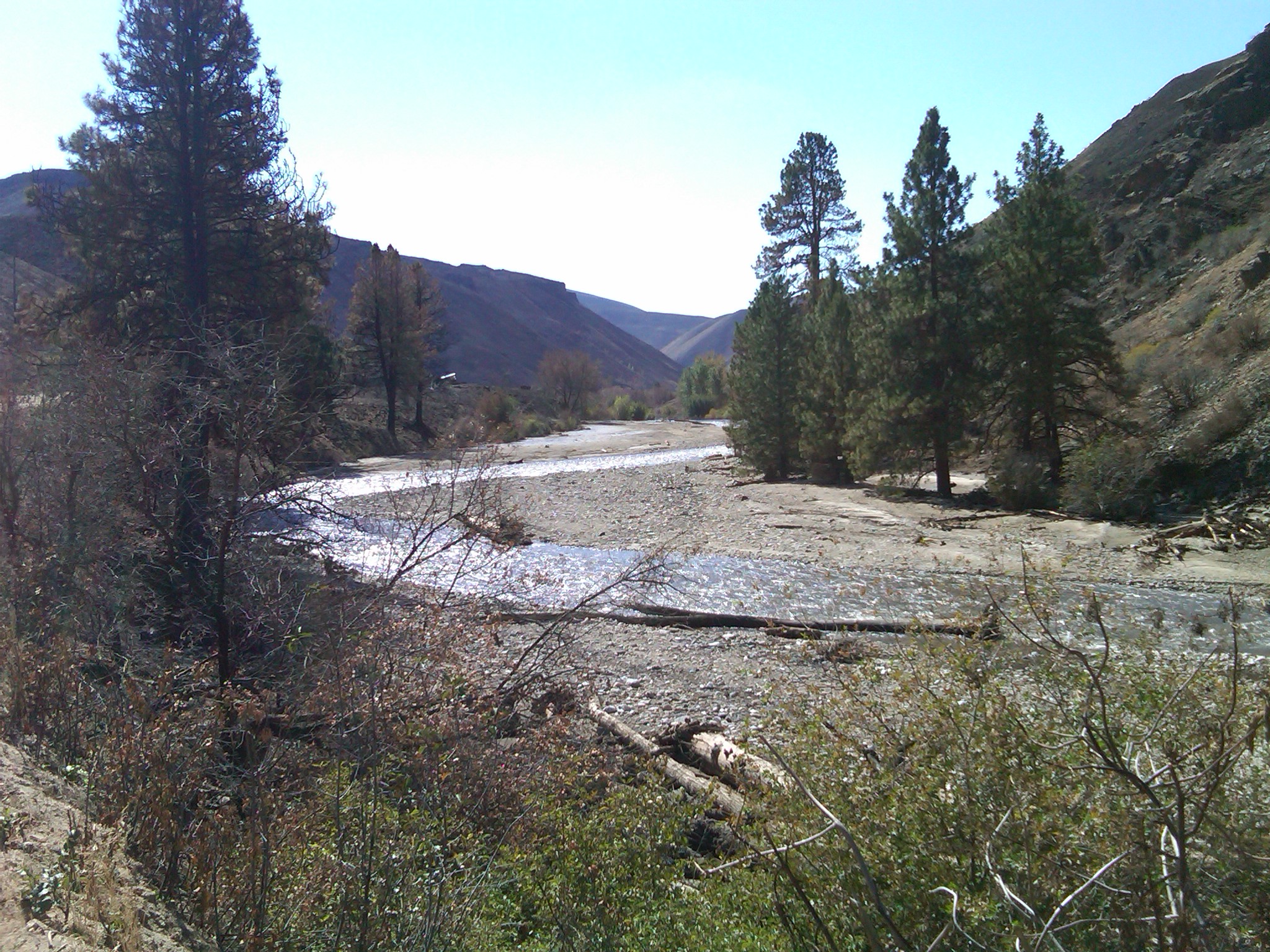
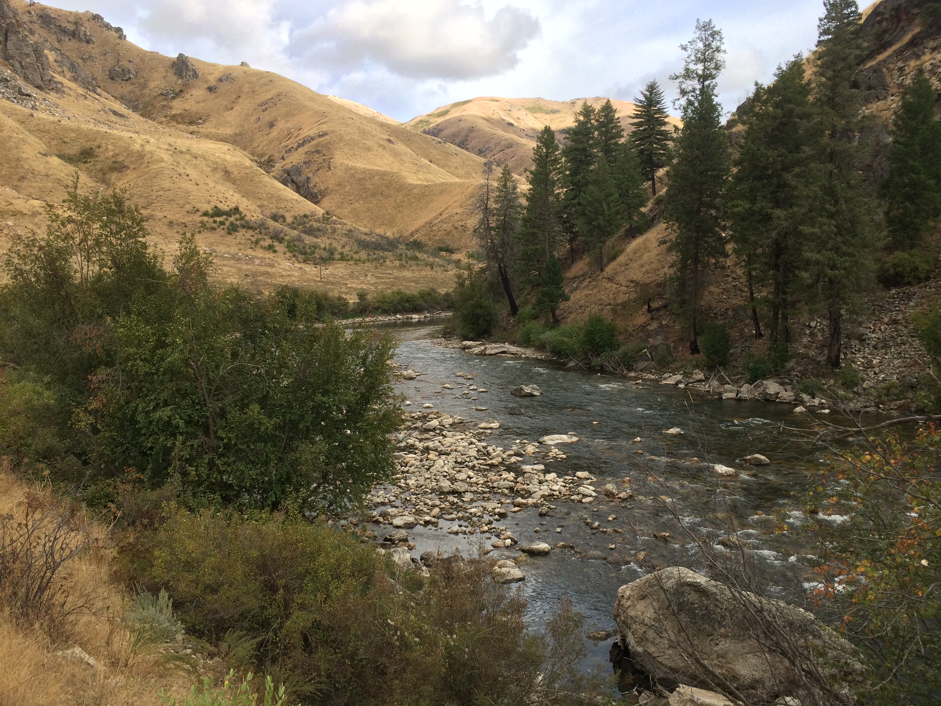
    Moving downstream a couple hundred years and then during the photo looking upstream the debris has been moved out of this section.

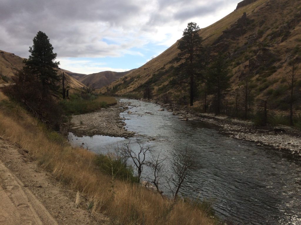
    A final photo set, looking upstream, at the head of the pocket water above the pine tree hole.


  • A geology tour of the South Fork Boise

    As the South Fork Boise is currently closed to fishing now is the time to dip into stacks where we can find out a thing or two about the general area where the South Fork flows.  This installment is a geology tour.  At Idaho State University they have lots of geology information posted on line, including the Guidebook to the Geology of Central and Southern Idaho.  In that book is the chapter “Cretaceous and Tertiary Intrusive Rocks of South-Central Idaho,” which includes a tour of the South For Boise River canyon area.

    This geology tour begins with the road approaching Anderson Ranch Dam and goes downstream to the Cow Creek bridge where you drive from the South Fork back to Highway 20.  Included is a side trip from Cow Creek Bridge to Danskin Bridge.

    A couple of notes.  The zero point for the tour, shown as 0.0, is the intersection of Sun Valley Road and Main Street in Ketchum.  So the tour approaches the South Fork Boise from the east.  Secondly, the interval mileage is shown in parentheses.  Here goes: (more…)

  • Fall on the South Fork Boise

    Fall on the South Fork Boise.